Travel Blog
Dong Du Village Lakeside Farmstays

The Muong Long Loop - Nghe An Motorbike Guide
Updated: 28/1/2024 | 7:44:22 PM
Nghệ An is the biggest province in Vietnam, yet it’s one of the least explored by travellers. Riders usually skip this region, treating it as a sort of ‘flyover’ province between central and northern Vietnam. In reality, however, Nghệ An is one of the best riding regions in the nation and should be considered a major destination for road-trippers. The Mường Lống Loop is a motorbike route to rival any other in Vietnam for scenery and adventure. This route stretches from the coast in the east to the mountainous border with Laos in the west, culminating in a mini-loop near Mường Lống, a remote village in the far northwest of the province, which is, without a doubt, one of the best stretches of road and scenery anywhere in Vietnam. The Mường Lống Loop is a real adventure, the likes of which are slowly disappearing in other provinces, as they become popular tourist destinations.
A Spectacular Circuit of the Nation’s Biggest Province
This guide includes a detailed route map, an overview of helpful information, and a description of each section of the loop. I’ve broken the route into 4 sections, each of which could correspond to one day on the road, but it depends entirely on how you like to ride and how much you want to stop and sightsee along the way. The ideal length of time for the Mường Lống Loop is 4-7 days. Road conditions are generally good and gas stations are at regularly intervals throughout the loop. I’ve written this guide going clockwise on the loop, starting in Vinh, but you can ride it in either direction. There are lots of opportunities for detours, but be careful of the tempting roads along the Lao border: as a foreign rider, you don’t have a right to be there and will likely be stopped and turned back.
Overview & Details:
Below is a quick overview of the loop and a brief outline of each section, followed by more specific details about important considerations, such as weather conditions, police and borders, accommodation, food and drink, sights and activities, and more.
QUICK DETAILS:
- Route: a large, thrilling, off-the-beaten-path circuit exploring the nation’s biggest province
- Distance: 630km (main loop)
- Duration: 4-7 days
- Scenery: verdant agricultural valleys, limestone karsts, brooding mountains, glistening rivers, rice fields, waterfalls, tea hills
- Attractions: magnificent landscapes, remote villages, historic sites, homestays, farmstays, caves, national parks, wildlife, waterfalls, borderlands
- Road Conditions: good paved roads, occasional rough patches, opportunities for detours
- Best Time: March - August
Section 01:
Vinh→Kim Liên→Thanh Chương→Con Cuông | 130km
Vinh, the capital of Nghệ An Province, lies just north of the Lam River, bounded to the west by Highway QL1A, and to the east by the ocean and the Gulf of Tonkin. The city is neatly laid out along wide boulevards, expansive squares and large parks. Vinh was almost completely destroyed by U.S bombing in the 1960s and 70s, but the old city can still just about be glimpsed down narrow, curving lanes, and particularly around the Thành Cổ (old citadel), whose handsome gates still grace each side of the moated enclosure. The city is friendly, pleasantly slow and quiet by urban Vietnamese standards: good for walking or riding around for a day or two at the beginning or end of the Mường Lống Loop. There’s lots of decent budget and mid-range accommodation, plenty of food and shops, a museum, and Nocenco Coffee, a rooftop cafe designed by famous Vietnamese architect Võ Trọng Nghĩa in his signature bamboo style. However, Vinh isn’t a place to linger when there’s so much more of Nghệ An Province to explore.
Heading west of Vinh on road QL46A, the city quickly disappears into rice fields and lotus lakes. Just off the main road, Kim Liên is the birthplace of Ho Chi Minh. Today, the village is preserved, largely as it would have appeared in Ho’s youth at the turn of the 20th century, as a memorial to the man who’s seen by many as the father of the nation. Kim Liên is free to enter and a very attractive complex of gardens, trees, ponds, wooden homes, temples and memorials. The site is popular with Vietnamese tourists, but very few foreigners visit. The atmosphere is informal, even jovial, rather than serious and deferential, as it is at Ho’s mausoleum in Hanoi. An hour at Kim Liên, walking around and pondering the beginnings of an extraordinary life, is worthwhile. Đền Chung Sơn is a nearby temple specifically for the worship of Ho’s family.
Continue south of Kim Liên to the banks of the Lam River, then follow its course upstream due west on road QL46A through Nam Đàn, then across the river on QL46B through increasingly pretty landscape until hitting the Ho Chi Minh Road. Turn due north and stop to visit the tea hills of Thanh Chương. Tea has been grown in northern Vietnam for many centuries. What makes the plantations at Thanh Chương unique is that the hills are surrounded by water; the valley below was flooded by a dam upstream, creating the impression of ‘floating tea hills’. Several lanes lead to the lake shore, where boats ferry visitors around for photos and even onboard meals. There’s good lakeside accommodation, too. A night here is a tranquil, memorable experience.
Ploughing north on the Ho Chi Minh Road, the riding and scenery are good. A tempting detour due west to Thác Mưa waterfall is, however, best avoided for now, due to its proximity to Laos and the likelihood of being stopped by border police. Instead, keep straight on until the crossroads at Khai Sơn and turn left onto QL7A, a fantastic road and the beginning of the western branch of this loop, leading deep into remote and mountainous corners of Nghệ An Province.
After 40km, the town of Con Cuông appears on a broad sweep of the Lam River, surrounded by limestone karsts. There’s food and accommodation in and around the town, including a homestay cluster across the bridge in Bản Khe Rạn hamlet, and even a large, mid-range hotel with a pool, Mường Thanh Holiday. Most of the dining options can be found around the intersection near the town’s market; there’s also a supermarket, which is good for supplies. Con Cuông is a decent base for a night, but another option is to head a little southeast of town to the homestays in Yên Khê and Môn Sơn villages, such as Hanh Chiến homestay and Qúy Thỏa Ecolodge. These are good-value, atmospheric places to stay, and they’re nearby Khe Nước Mộc spring (which also has a good restaurant) and the Phà Lài boat pier. Unfortunately, the latter, which is the base for boat trips along a scenic river, is currently off-limits to foreign visitors, unless they have a permit obtained in Vinh. In reality, this means that, as a foreign traveller, you should stay away from the Phà Lài boat pier or risk a lengthy interrogation by border authorities.
Thankfully, there are no such restrictions on foreign visitors for the region’s star natural attraction, Thác Khe Kèm, a beautiful cascade falling from a lofty height in the midst of jungle-covered mountains. A lovely 30-minute ride south of Con Cuông, the falls are tastefully (for the most part) developed for visitors, including raised walkways, viewing platforms, and food and refreshment shelters in wooden shacks by the stream. Entrance is 30,000vnd. Try to avoid weekends and public holidays, when the waterfall can get crowded.
Section 02:
Con Cuông→Mường Xén→Mường Lống | 150km
Leave Con Cuông on road QL7A heading due west for the long, hundred-kilometre ride toward Mường Xén and Nậm Cắn international border crossing with Laos. The Lam River valley sprawls into the distance, winding its way upstream into the highlands of Laos. Rice paddies and fields of maize and sugar cane grow along the river’s flat banks, meeting its languid waters; on the horizon, limestone pinnacles rise in formation like a phalanx of stone troops – a natural line of defence protecting the forested peaks of Pù Mát National Park, which loom large into the sky, merging with the clouds. Despite being a major route for trade with Laos, this meandering highway is quiet, smooth and scenic: a pleasurable ride with several points of interest to stop at along the way.
Pù Mát National Park HQ is just west of Con Cuông, and south of the highway are several waterfalls and streams reached via paved lanes, such as Nậm Xán and Văng Phột. A forest of ancient Săng Lẻ trees, with their buttressed trunks and distinctive grey-yellow hue, makes for a good roadside stop. A trail leads through the forest – humming with cicadas – and there are refreshments in a wooden restaurant. Just beyond the town of Hòa Bình, where there’s a decent hotel and rice eateries, are two curious historical sites by the river. Cổng Phủ Tương Gate is tucked away down an anonymous back lane at Cửa Rào, a junction of two rivers. The gate, which must be many centuries old, is perfectly decorated by the long, creeping tentacles of an ancient banyan tree, whose roots have encased the old gate as if wrapping it up for preservation. There’s hardly any information available, either online or locally: the gate, it seems, is a mystery lost to history. On the opposite bank of the river, Đền Vạn Cửa Rào is a recently rebuilt temple on the site of a 14th century burial mound where Vietnamese general Đoàn Nhữ Hài and his soldiers died during a battle with Lao troops in 1335. Next to the temple is a 700-year-old banyan tree, dating back to the time of the battle.
The second half of QL7A drives deeper into the mountains: valleys become steeper and the terrain more threatening, with the slopes of Phu Xai Lai Leng a constant presence to the west. At 2,720m (8,924ft) it is, to the best of my knowledge, the highest mountain in all of southern and central Vietnam. Surrounded by a ring of peaks, Mường Xén is the last town on the road to Laos. A riverside settlement with a frontier atmosphere, there are a few OK hotels here if you need to overnight (Phanh Dần 2 and Hải Vân are probably the best options). The main street also has some local eateries and cafes. People are friendly, the light is sharp and the air cool, but Mường Xén isn’t a destination in itself: you can use it as a base for a brief detour up the Noọng Dẻ Pass to the Nậm Cắn border gate and back, which is a scenic route if you have the time or inclination; otherwise, it’s better to continue on the loop to Mường Lống for the night.
Branching northeast from Mường Xén town, the fabulous Tây Nghệ An road begins its mountainous course through a remote corner of the province, via some of the most sensational scenery in Vietnam. For 30km the road climbs up a series of zigzagging passes to the Ngã Ba intersection. Here, take a brief 10km detour branching east to Mường Lống, a hamlet at high altitude, hidden among a forest of limestone peaks. The road to Mường Lống crawls along a steep, deep valley, opening up big views across high ridges disappearing into the distance. The road narrows to a single-track lane beneath a limestone ridge, passing Cổng Trời Mường Lống (Heaven’s Gate) at a height of 1,500m (4,921ft), the same elevation as the highland resort towns of Sapa and Đà Lặt. Indeed, Mường Lống, which fills the valley beyond Heaven’s Gate, is being touted as a ‘new’ highland retreat. However, for now it is but a fledgling homestay destination in a pretty location with one brand new resort, perhaps heralding the start of tourist development here.
Phú Vân Farmstay is a good place to begin your hunt for accommodation in one of the half a dozen traditional wooden houses that offer guests a night on a mattress on the floor. Remember to ask for dinner in advance, because there’s not much else to eat in the village. Mường Lống Eco Garden boasts private A-frame chalets with excellent views, an infinity pool and a restaurant and bar with good coffee. Nearby, Thác Rồng (Dragon Waterfall) is a beautiful spot. The nights can be cold in Mường Lống, even in the summertime.
Section 03:
Mường Lống Mini-Loop→Quế Phong→Hoa Tiến→Qùy Châu | 170km
Mường Lống is a pretty village, but its main appeal is as a base for riding and exploring the incredible roads and landscapes surrounding it, all of which are contained in a mini-loop so breathtaking and majestic that it’s worth riding several times over. Start by driving back through Heaven’s Gate and turning due north on a small, paved road which echoes the contours of the massive limestone mountain whose ‘waist’ it traverses. The views are sublime. Dropping sharply into a tight valley between limestone cliffs, the road passes caves and streams until it meets the Tây Nghệ An road at Xốp Tự intersection. Turn left (due west) to ride the northern crest of this mini-loop, sweeping along the edges of a big, muddy river to Mỹ Lý village. Here, take a short detour on a back road, across a suspension bridge to Yên Hòa, a remote hamlet where there is, quite unexpectedly, an ancient, leaning Buddhist tower (Tháp Cổ Yên Hòa). There’s no information, just a notice warning you to stand clear, because the ancient structure may topple at any moment. It’s said the tower could be anywhere between 400-900 years old. (There are a couple of homestays in the hamlet.)
Back on the mini-loop, ride west into a limestone valley of gigantic proportions, where time and weather have bored holes into the white cliffs like gaping wounds. It has the feel of a prehistoric landscape: one expects to see giant beasts striding out of the jungle chased by ancestors of homo sapiens wielding primitive weapons on a hunt. The road bends south, beginning the western flank of the mini-loop, which is perhaps the most astonishing of all. For 10km, switchbacks and hairpins carve a path through the mountains, the views becoming grander and more jaw-dropping with every bend. Traffic is non-existent, the road is in excellent condition, and the lines of sight are unbroken in all directions. Take it slowly and drink it all in. Eventually, the mini-loop comes back to the Ngã Ba intersection, where you can cut across, once again, to Mường Lống.
Once you’ve had your fill of the mini-loop, continue on the main loop by turning due east at the Xốp Tự intersection and following the Tây Nghệ An road towards Tri Lễ. The riding is easy and pleasant, cutting along the edge of a steep river valley, passing pockets of rice paddies folded into the mountains. After Thác Nha Vang waterfall (worth a stop), the Tây Nghệ An road becomes DT543 whose smooth, wide tarmac glides through lush agricultural valleys, passing waterfalls and farmstays, for 40km all the way to Quế Phong town (also known as Kim Sơn) and the intersection at Tiền Phong (both towns have a couple of decent hotels, if you need them). From Tiền Phong an optional detour to remote Thác 7 Tầng waterfall is fun if you have the time.
As you continue due southeast on road QL48A, the high peaks begin to give way to flat river plains and farmland enclosed by a ring of limestone pillars. Take a detour to Hoa Tiến village where several of the wooden stilt houses operate as homestays. The village is close to an attractive river surrounded by glimmering rice paddies which are irrigated by bamboo waterwheels dotted along the riverbanks. It’s very pretty and most of the homestays can arrange short boat trips on the river and walks into the fields. Hoa Tiến is also a good base from which to explore the easily accessible limestone caves of Hang Bua and Hang Thẩm Ồm, reached by paved backroads through picturesque countryside. Entrance to both caves is free. Hang Bua is relatively large with impressive formations inside; Hang Thẩm Ồm is smaller and difficult to find (it’s also very dark: bring a flashlight), but much more of an adventure. If you don’t fancy sleeping at one of the homestays in Hoa Tiến, a good alternative is to continue 10km south to Qùy Châu town where Hải Thuyên Hotel is a comfortable option for a night.
Section 04:
Qùy Châu→Qùy Hợp→Tân Kỳ→Cửa Lò | 180km
The last leg of the Mường Lống Loop heads south from Qùy Châu on DT544, a twisting rural backroad leading through pleasant scenery all the way to Qùy Hợp town. A centre for quarrying and heavy industry, Qùy Hợp is surprisingly large and busy, with good hotels and lots of food, but it’s not really a place to stay for long. Continue due south on road QL48D through more lush and increasingly lowland scenery. About halfway to Tân Kỳ there’s an optional detour on a small road to the spectacular Thác Hồng Sơn – well worth a visit if you have time. Otherwise, stay on QL48D down to the Hiếu River valley which, although pretty, is blighted by trucks, dust and industry. The town of Tân Kỳ has a couple of good hotels and the KM0 Monument, which marks the beginning of the legendary Ho Chi Minh Trail, a supply route for troops and military materiel from north to south Vietnam during the war in the 1960s and 70s.
From Tân Kỳ several roads lead east, becoming increasingly urban, until finally hitting the ocean at a barren, rocky headland. From here, it’s possible to wind your way on coast roads all the way south to the long, wide, sandy beach of Cửa Lò. There’s plenty of accommodation – resorts, hotels and guest houses – along the oceanfront in which to spend your last night by the beach, swimming in the sea, drinking a cocktail or two, and feasting on a seafood dinner. To complete the loop, Vinh is just a 30-minute ride southwest of Cửa Lò beach.
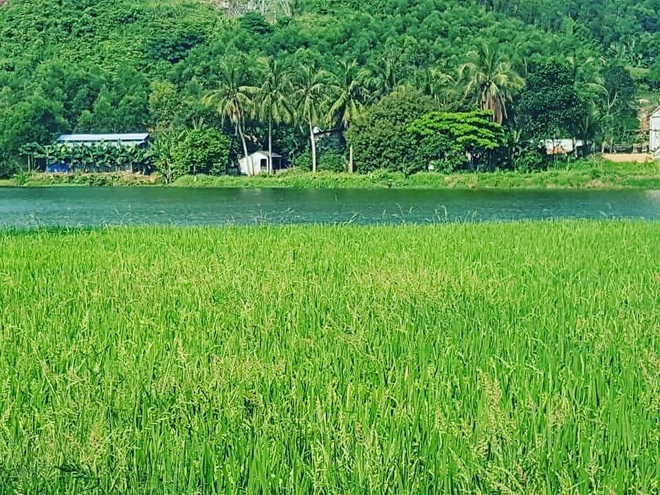
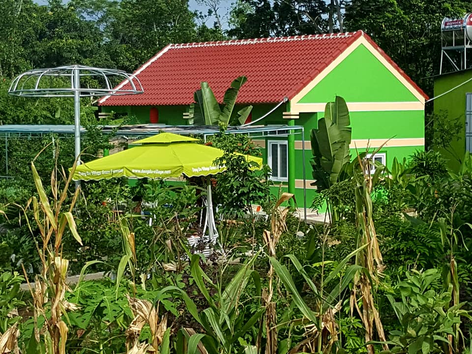
From Tân Kỳ , you can go further to North of Vietnam, about 40km away where you can stay at Eco Farmstay Dong Du located in beautiful and peaceful villages to explore Dong Du valley before going to Tam Coc/ Bich Dong in Ninh Binh. Please contact Ethnic Voyage for more informations.
(Source: Ethnic Voyage Vietnam)
Other news
- Things to do and see in Western Nghe An
- Let's explore the hidden gem of Pu Luong Nature Reserve
- Tham Om & Bua Caves - Western Nghe An
- Bay Tang & Sao Va Waterfalls – A Mysterious Gem Of Western Nghe An
- Community Based Tourisme and homestay tours delight foreigners in Western Nghe An
- Responsible tourism in Vietnam
- Back to nature in Central Vietnam’s Pu Mat National Park, Western Nghe An
- The most famous tourist spots and attractions in Nghe An, Vietnam
- Nghia Dan Sunflowers Valley Attracts Beauty Seekers in Western Nghe An
- Pu Mat Natural Park - Western Nghe An