Blog de Voyage
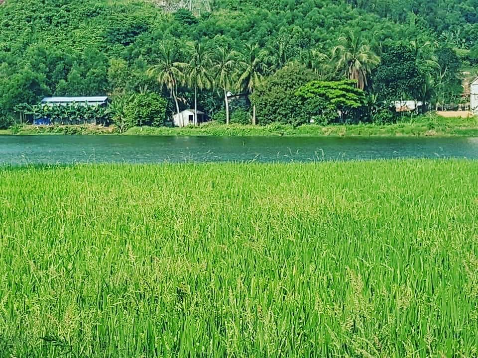
Dong Du Village

Annamite Range - Western Nghe An
Updated: 23/3/2020 | 4:55:45 AM
The Annamite Range or the Annamese Mountains (French: Chaîne annamitique; Lao: ພູ ຫລວງ Phou Luang; Vietnamese: Dãy (núi) Trường Sơn) is a mountain range of eastern Indochina. It extends approximately 1,100 km (680 mi) through Laos, Vietnam, and a small area in northeast Cambodia. The mountain range is also referred to variously as Annamese Range, Annamese Mountains, Annamese Cordillera, Annamite Mountains and Annamite Cordillera.
The highest points of the range are 2,819 m high Phou Bia, 2,720 m high Phu Xai Lai Leng and Ngọc Linh (Ngoc Pan), 2,598 m (8,524 ft). The latter is located at the northwestern edge of the Triassic Kontum Massif, in central Vietnam.[1] Important passes are the Nape Pass and the Mụ Giạ Pass.
The Annamite Range runs parallel to the Vietnamese coast, in a gentle curve which divides the basin of the Mekong River from Vietnam's narrow coastal plain along the South China Sea. Most of the crests are on the Laotian side. The eastern slope of the range rises steeply from the plain, drained by numerous short rivers. The western slope is more gentle, forming significant plateaus before descending to the banks of the Mekong. The range itself has three main plateaus, from north to south: Phouane Plateau, Nakai Plateau and Bolaven Plateau.
Laos lies mostly within the Mekong basin, west of the divide, although most of Houaphan Province and a portion of Xiangkhoang Province (where the famous Plain of Jars is located) lie east of the divide. Most of Vietnam lies east of the divide, although Vietnam's Tây Nguyên (Central Highlands) region lies west of the divide, in the Mekong basin.
"An-nam" means in Chinese "to pacify the south", referring to the region's location relative to China.
Ecology
The Annamite mountains form an important tropical seasonal forest global ecoregion, the Annamite Range Moist Forests Ecoregion, which consists of two terrestrial ecoregions, the Southern Annamites montane forests and the Northern Annamites moist forests.[2]
The range is home to rare creatures such as the recently discovered Annamite rabbit and the antelope-like saola, the Douc langur, the large gaur, the Chinese pangolin, and the Indochinese tiger.
History
Most of the highlands like the Annamite Range and the Central Highlands were populated by ethnic minorities who were not Vietnamese during the 20th century's start. The demographics were drastically transformed with the mass colonization of 6 million settlers from 1976 to the 1990s, which led to ethnic Vietnamese Kinh outnumbering the native ethnic groups in the highlands.
Phu Xai Lai Leng mountain
Phu Xai Lai Leng is considered the highest mountain in Nghe An province and higher than all other mountains of the Truong Son range. According to the notes of geographers, Phu Xai Lai Leng peak on a 2.711m altitude, stretching from the northwest Nghe An on the border with Laos to Hong Linh mountain in Ha Tinh province.
Phu Xai Lai Leng appears like a bulky majestic wall. Over the landmark 422, on the other side is Xieng Khouang Province, Laos, at the foot of Phu Xai Lai Leng on Vietnam territory is Na Ngoi commune with more than 5,000 people, H'mong people account for 80%. Phu Xai Lai Leng in the H'mong language means "seen everywhere" referring to the lofty height of the mountain.
Phu Xai Lai Leng is also the station of the military border forces. To discover the high peak, people have to register at the Na Ngoi border station, the officers, border guards here who are willing to help. This border region is characterized by subregion climate, midday is burning hot, afternoon thunderstorms and lightning, evening is freezing cold.
Explore Phu Xai Lai Leng is not simply climb a high mountain but also learn the cultural life of local residents. At the foot of Phu Xai Lai Leng is 17 H'mong villages, in which Buoc Mu is typical with an ancient history of over hundred years.
(Source: Dong Du Eco Farmstay)
Autres Nouvelles
- The Western Nghe An Biosphere Reserve
- Explore Western Nghe An while staying in Dong Du Eco Farmstay
- For a green Halong Bay
- A Different Way of Life in Cai Beo Fishing Village - Lan Ha Bay
- Phu Xai Lai Leng mountain
- Le sommet Phu Xai Lai Leng et la Chaîne Annamitique
- Unique homestay tours delight foreigners in Quy Chau, Nghe An
- Découverte du parc national de Pù Mat - réserve biosphérique mondiale
- Discover Pu Mat Natural Park and Homeland of HCM
- Dong Du Eco Farmstay and Pu Mat National Park